Redevelopment Authority / TIRZ 20
Redevelopment Authority / TIRZ 20
Redevelopment Authority / TIRZ 20
Redevelopment Authority / TIRZ 20
Redevelopment Authority / TIRZ 20
Redevelopment Authority / TIRZ 20
Redevelopment Authority / TIRZ 20
Redevelopment Authority / TIRZ 20
Our Purpose: To attract new investment and redevelopment through public infrastructure and facility improvements in an area that extends from Westpark Tollway to the Willow Waterhole.
Since TIRZ Creation:
$2.5 billion
increase in taxable value
$90 million
has been funded in projects to date
roadway panel replacements completed
of new sidewalks constructed
Our Purpose: To attract new investment and redevelopment through public infrastructure and facility improvements in an area that extends from Westpark Tollway to the Willow Waterhole.
Since TIRZ Creation:
$2.5 billion
increase in taxable value
$90 million
has been funded in projects to date
panel replacements completed
of new sidewalks constructed
Project Highlights

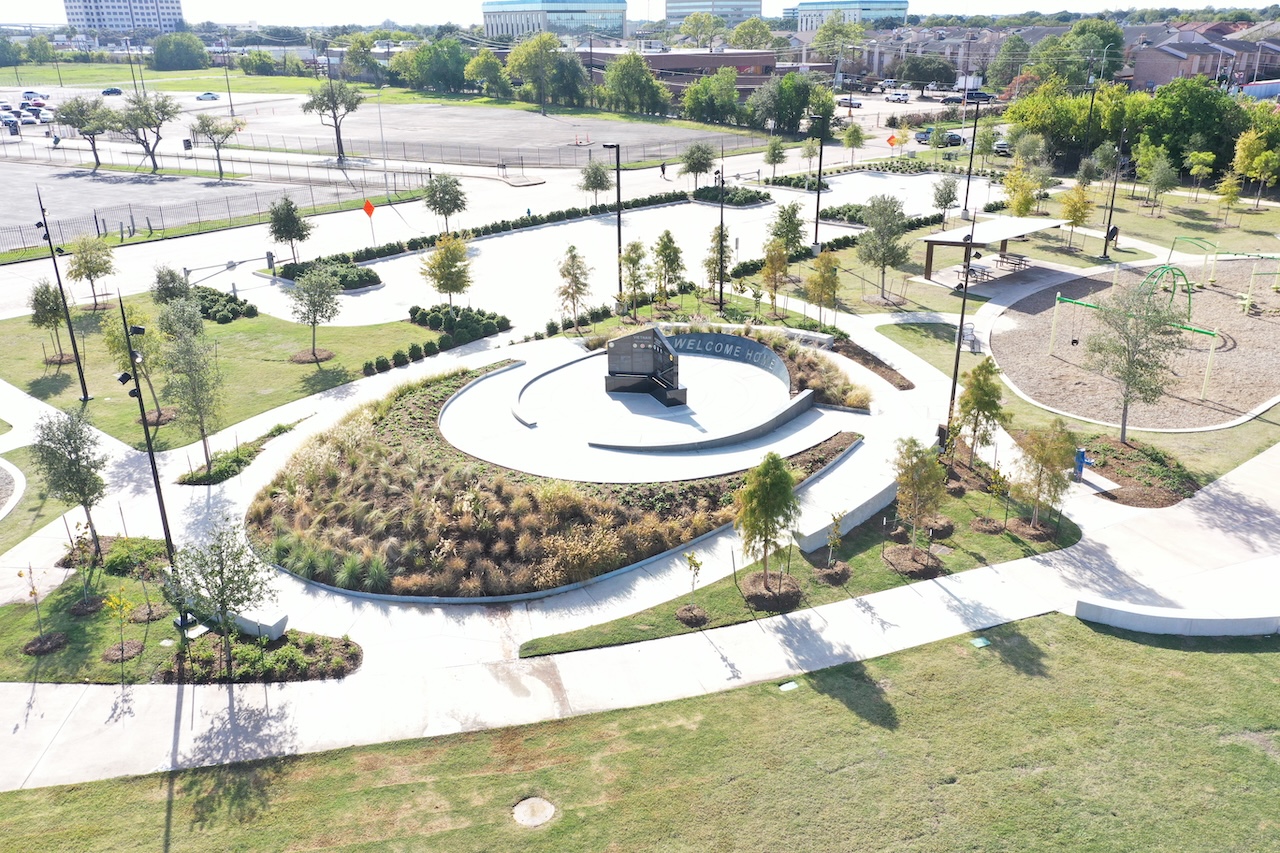
T-2004
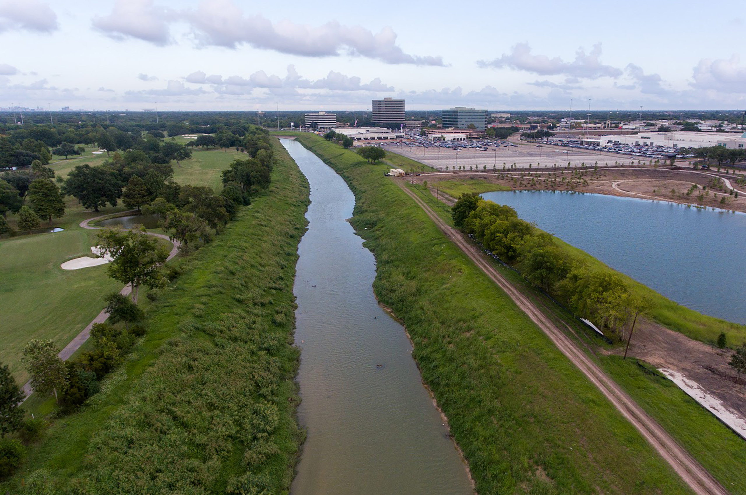
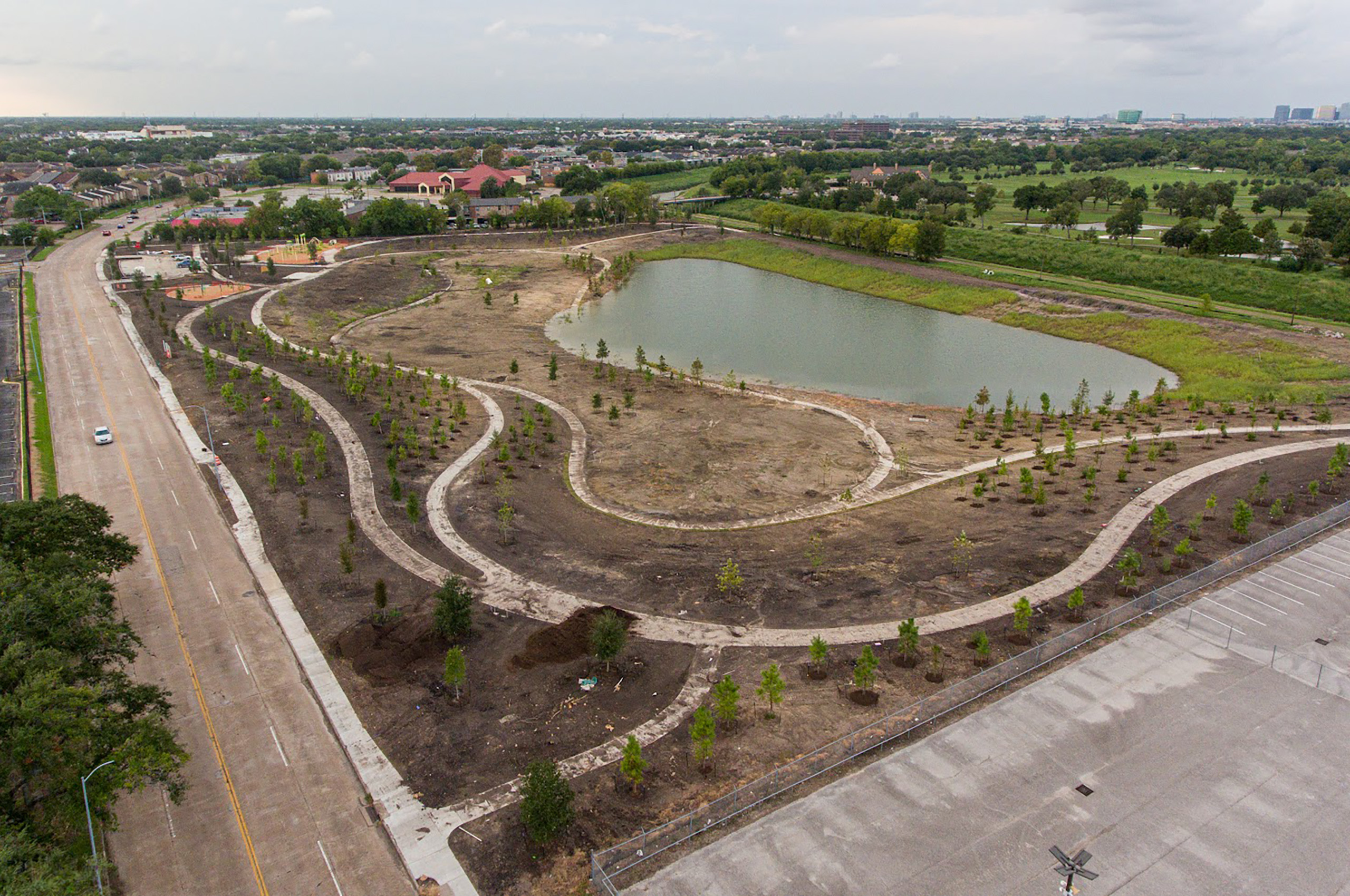
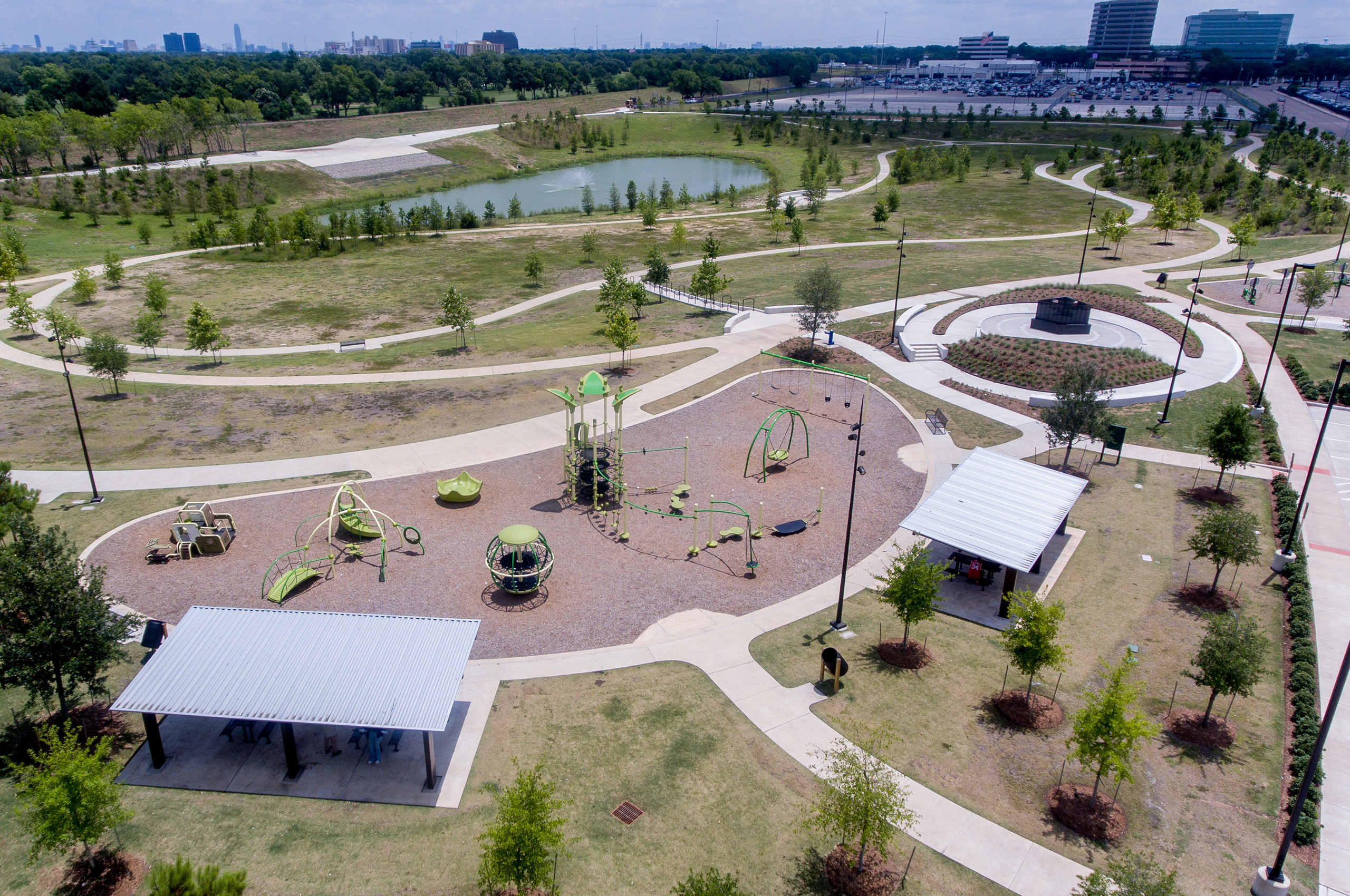
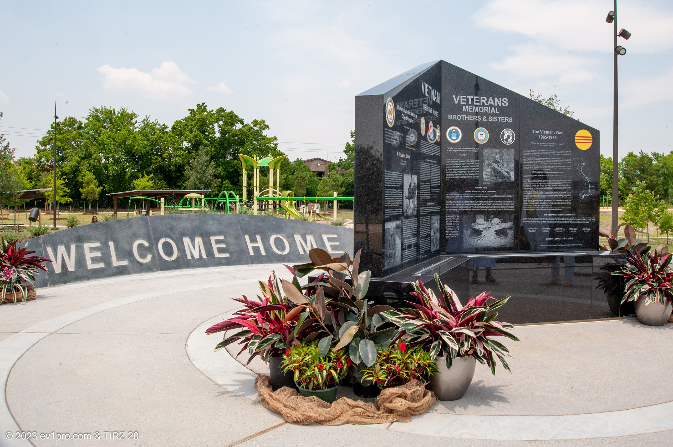
A park and greenspace facility that includes a 120 acre-feet detention basin, multi-use trails, playground area, fitness equipment, Vietnam Veterans War Memorial, and associated parking, located at Country Creek Street and Club Creek Drive. This project was jointly funded by the TIRZ, City of Houston and Harris County Flood Control District. This project was recently completed in 2023 and the park is open to the public.

T-2008
This project includes a 3.12-mile concrete CenterPoint Trail parallel to S. Gessner Rd between Westpark Tollway and Southwest Freeway connecting to the Brays Bayou Greenway Trail. The project is divided in three phases, Phase I consists of the area between Sands Point Drive to Beechnut Street and Phase II consists of Beechnut Street South to Brays Bayou Greenway.

T-2010A
The project consists of the reconstruction of the Harwin Dr. & S. Gessner Rd. Intersection to improve traffic mobility and pedestrian safety in the area.
TIRZ 20 Celebrates Ribbon‑Cutting of the Sharpstown Trail: A Milestone in Community Connectivity
On Saturday, June 7, 2025, community spirit shone brightly at the ribbon‑cutting for Phase 1 of the Sharpstown Trail. Hosted by Houston Parks Board in collaboration with Southwest Houston Redevelopment Authority/TIRZ 20, Harris County Precinct 4, and Southwest Management District, [...]
Stay up-to-date on our projects, upcoming community meetings, future plans, and more.